
How a Mossad/IDF raid inspired the first Google Maps
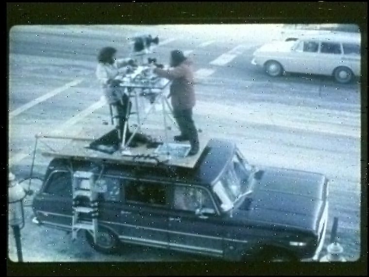
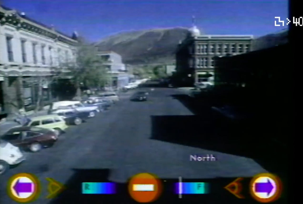
I’ve been doing some research for my Vampire Valley doc and I came across something that I think I mentioned in Surveillance Valley only in passing (it got one sentence in a footnote in a section that looked at how the Pentagon was behind pretty much every computer feature that we rely on today)…and it’s this: the Aspen Movie Map, the first experimental version of what Google would later roll out as Google Street View.
It’s interesting because this Pentagon-funded prototype, which showed that you could create a digital virtual reality map of a place, was inspired by the successful Israeli raid on Entebbe airport in Uganda to take out Palestinian and German hijackers rather than cede to their demands to release prisoners from Israeli jails. The raid mostly worked but it resulted in several Israelis getting killed, most of them by “friendly” fire from IDF commandos. Ooops. Bummer. Well, generals at the Pentagon looked at that raid and thought to themselves: “Imagine how much more effective they could have been if they trained using a real model of the place!” Or something like that. And so Street Maps Beta was born.
To me this project is just another mundane example of how we live the paranoid world the military created. Tools first made and marketed to generals as weapons got rebranded just a few years later as tools of personal liberation and consumer empowerment. No wonder the internet is such a negative force…
Funding to create a full-fledged movie map of Aspen came from the U.S. Defense Advanced Research Projects Agency (DARPA). In 1976, the Israel Defense Forces had rescued hostages from Uganda’s Entebbe Airport after preparing for the mission by training in a partial replica of the airport. DARPA saw that movie maps might provide a simpler, more affordable way to familiarize trainees with new locations.
